Phantom Image
of the Neo-landscape
The Phaistos Project: 45 Symbols
systems
research
2022
The Phaistos Project — Forty-five Symbols is a global project submission where designers translate current concerns — political, economic, ecological, cultural, or social challenges — into collections of forty-five unique symbols. Design methodologies are used as a mode of inquiry to develop ethnographic visual narratives that are subjective, stimulating, and capture visual traces of the anthropocene.
Concept
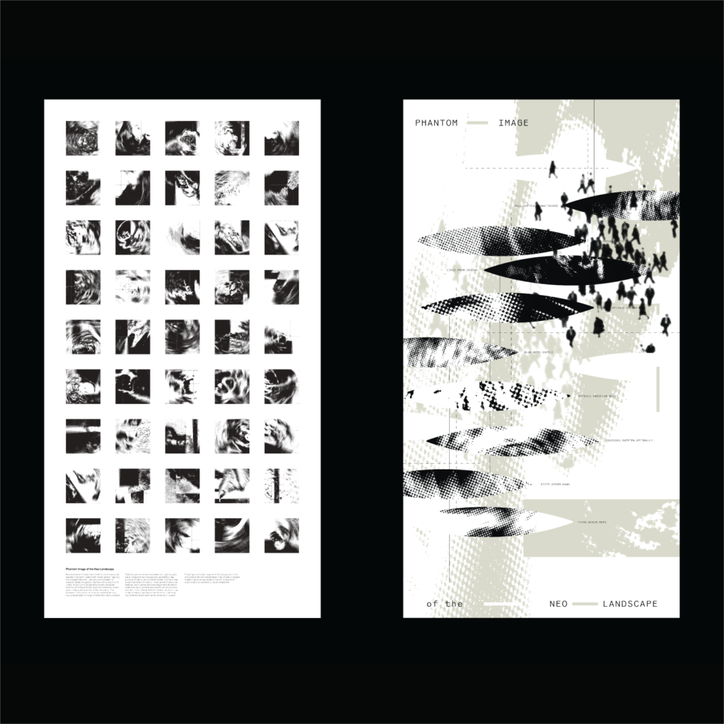
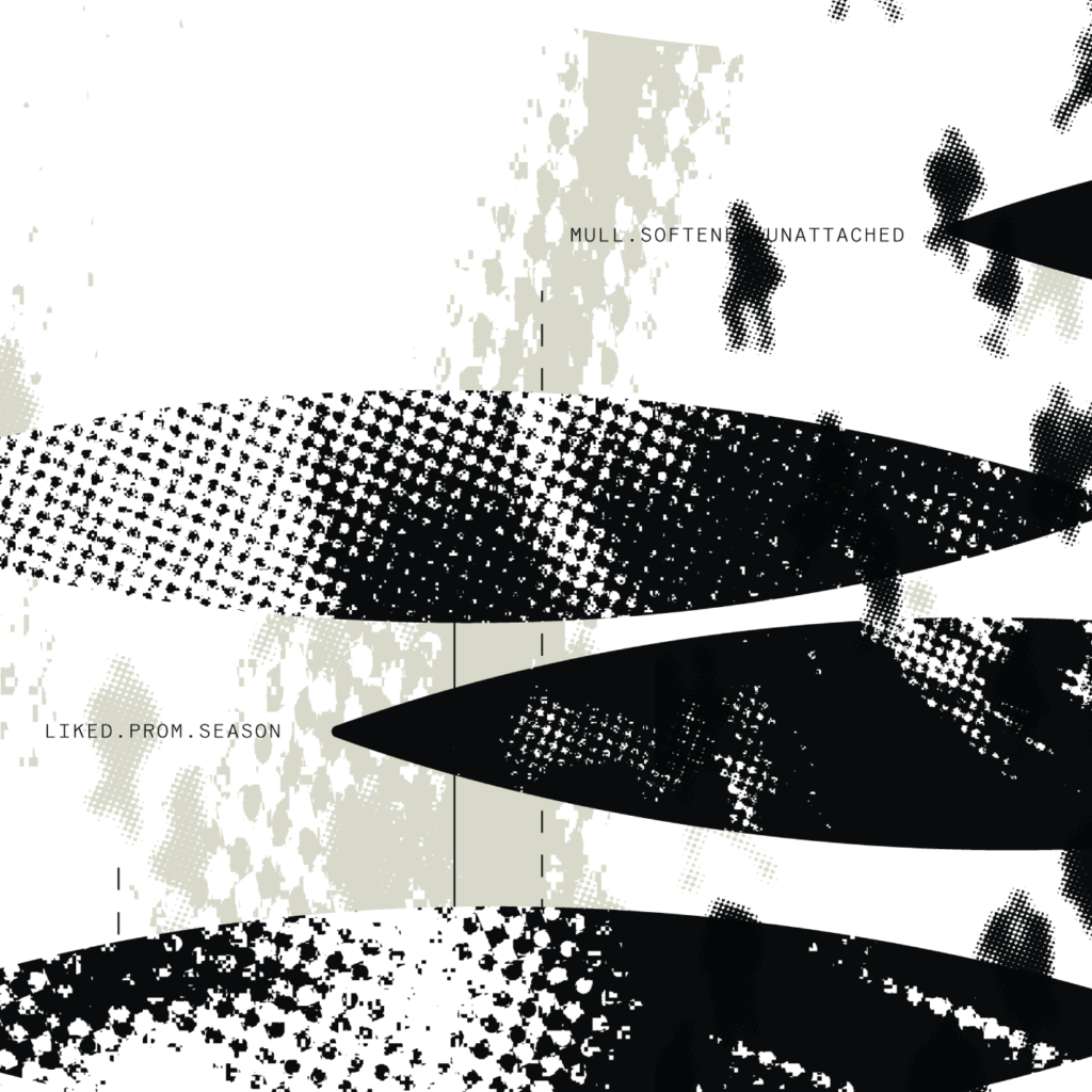
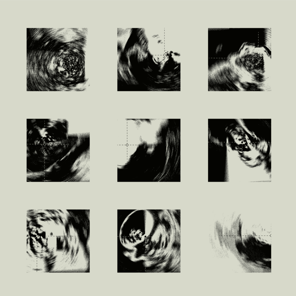
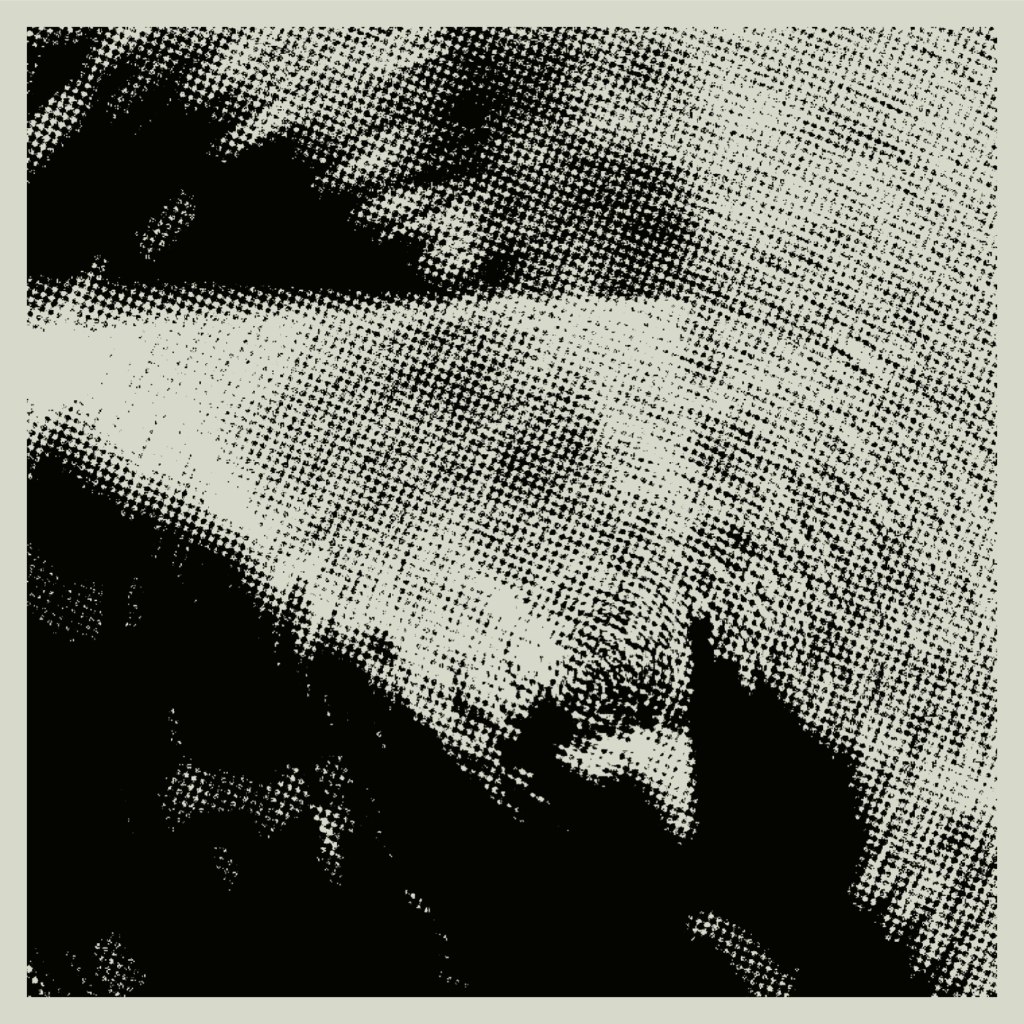
As advancements have been made to more accurately represent the earth, regions still remain where mapping technologies fall short. Like trying to hold water in clasped hands, the global map has a tendency to spill. These 45 symbols highlight where spatio-temporal dimensions of digital maps begin to humble the human goal to fully quantify and articulate the planet. The instance of this phenomenon is represented through manipulated satellite image of these blurred boundaries.
Technology has evolved and aided cartography past paper maps and spinning globes, generating new portraits of nature, yet the visible anatomy of earth has areas that remain inimitable. These areas of obscured features, even just surface-level vagueness do well to undermine socio-political boundaries, as natural ones are often not so clearly defined. Instead, shortcomings of digital maps may have come full circle to faithfully depict where wilderness has its moments of reclaim.
Symbols
Taking 45 observed instances of inconsistencies found on digital maps, these areas were further abstracted and stylized to form a compilation of 45 representative symbols. These symbols collect regions of the unmapped frontier and present the dilemma between man and technology’s analytic nature versus a planet that still proves to be unyielding to be summed up by its inhabitants.
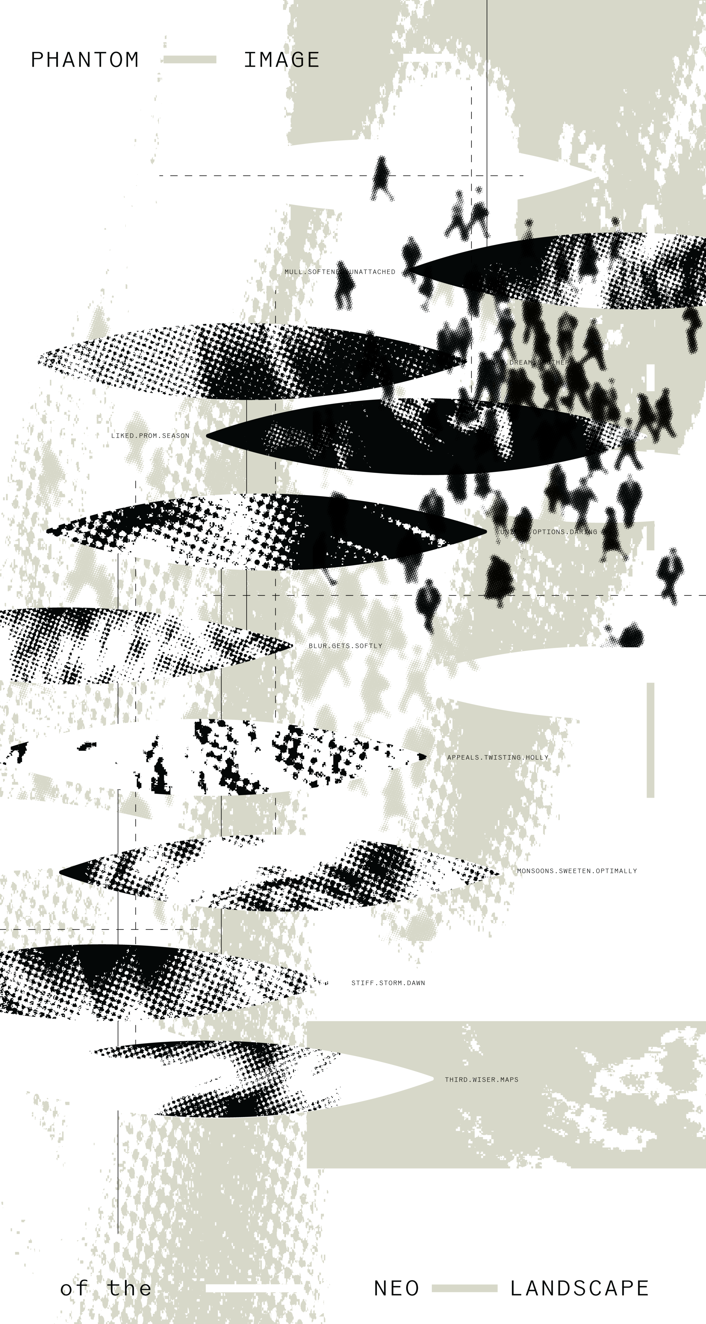
Poster
A thematic poster bridging the concept with the generated symbols. Coordinates provided from what3words examine the relationship between location and personal placemaking, as these coordinates are a series of 3 random dictionary words assigned to sections of the global map divided into 3 meter squares.
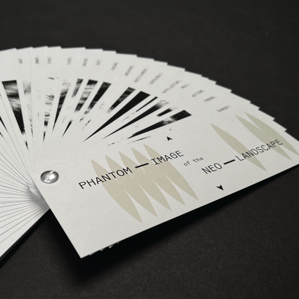
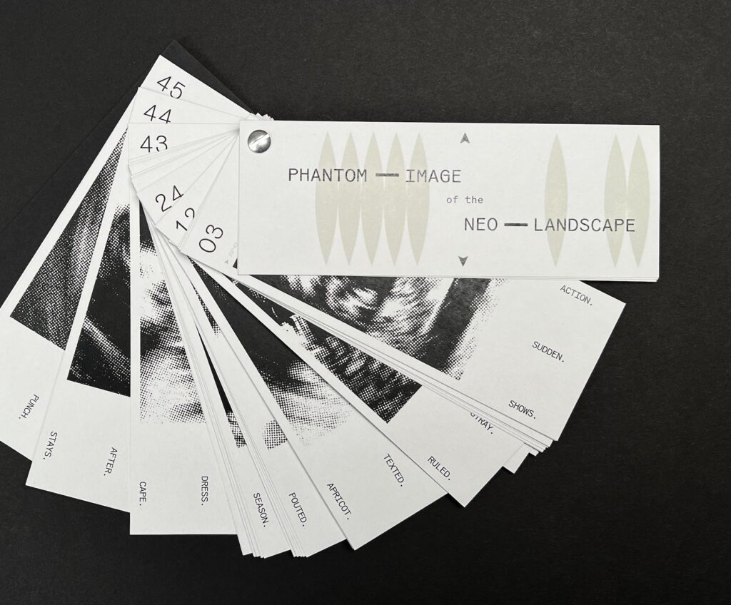
Booklet
A rotational axis is used that mimics both the planetary spin as well as the radial abstraction that makes up the symbols themselves. This booklet serves as an index of each of the 45 symbols withe the paired coordinates.
“The obvious world that we know on gross levels of sight, sound taste and touch, can be connected with the subtle world revealed by our scientific instruments and devices. Seen together, aerial maps of river estuaries and road systems, feathers, fern leaves, branching blood vessels, nerve ganglia, electron micrographs of crystals and the tree-like patterns of electrical discharge-figures are connected, although they are vastly different in place, origin and scale … Their similarity of form is by no means accidental. As patterns of energy-gathering and energy-distribution, they are similar graphs generated by similar processes.”
György Kepes